 Last additions - Suzu 珠洲市 Last additions - Suzu 珠洲市 |
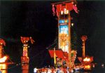
Hôryu Tanabata Kiriko Festival held on Aug. 7 in Suzu. 宝立七夕キリコ祭https://www.hot-ishikawa.jp/kiriko/en/kiriko/houryu.php
写真提供:©石川県観光連盟Jul 02, 2020
|
|
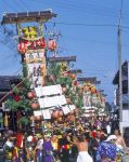
Takojima Kiriko Festival held in autumn in Suzu. Floats have lots of lacquered parts. 蛸島キリコ祭りhttps://www.hot-ishikawa.jp/kiriko/en/kiriko/takojima.php
写真提供:©石川県観光連盟Jul 02, 2020
|
|
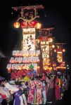
Takojima Kiriko Festival in Suzu. 蛸島キリコ祭りhttps://www.hot-ishikawa.jp/kiriko/en/kiriko/takojima.php
写真提供:©石川県観光連盟Jul 02, 2020
|
|
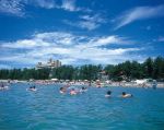
Hachigasaki Beach 鉢ヶ崎海水浴場写真提供:©石川県観光連盟Jul 02, 2020
|
|
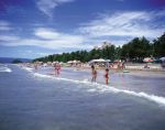
Hachigasaki Beach 鉢ヶ崎海水浴場写真提供:©石川県観光連盟Jul 02, 2020
|
|
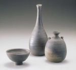
Suzu pottery写真提供:©石川県観光連盟Jul 02, 2020
|
|
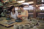
珠洲市陶芸センター写真提供:©石川県観光連盟Jul 02, 2020
|
|
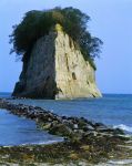
Mitsukejima island has a rock bridge for easy access. There's Mitsuke Shrine and wild birds like crows and cormorants. Uninhabited by humans.写真提供:©石川県観光連盟Jul 02, 2020
|
|
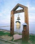
Lover's bell at Mitsukejima. The nearby beach has a swimming beach park, rest house, and camping grounds. Accessible by local bus from Wajima and Kanazawa.写真提供:©石川県観光連盟Jul 02, 2020
|
|

Made of white, diatomite rock, Mitsukejima island is 150 meters long, 50 meters wide, 28 meters high, and a perimenter of 400 meters, capped with Japanese pine trees. Free admission.写真提供:©石川県観光連盟Jul 02, 2020
|
|

Nicknamed "Battleship Island" (Gunkanjima), Mitsukejima island is Suzu's most famous attraction about 200 meters from shore. 見附島"Mitsukejima" means "Found Island," supposedly named by the priest Kukai (Shingon Buddhist sect founder) when it was the first island that he "found" on his way back from Sado island in Niigata. It was also "found" by a deity who descended here.
写真提供:©石川県観光連盟Jul 02, 2020
|
|
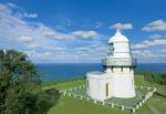
It took 2 years to build Rokkozaki Lighthouse. Made of highly durable stones hauled in 60 km by boat from Anamizu. From the boat, the stones were carried up the high cliff on a cable system.The lighthouse became automated (unmanned) in 1963. After over a century, this lighthouse still stands and operates. The light is visible for 33 km at sea.
写真提供:©石川県観光連盟Jul 02, 2020
|
|

Kihe'e-don is the former residence of the Sakurai family who engaged in salt and lacquer production. The "don" is the highest honorific in the Noto dialect. 喜兵衛どんBuilt in the mid-Meiji Period, it is a museum which attempts to show how the upper-class farmers of that time lived.Jun 29, 2020
|
|

Marker for "Center of the Japanese Archipelago" near Rokkosaki Lighthouse.Jun 29, 2020
|
|

Cape Rokkosaki is at the northernmost tip of Noto Peninsula and famous as where you can see both the sunrise and sunset over the ocean.On clear days, Sado island in Niigata Prefecture can also be seen.
Address: 石川県珠洲市狼煙町イ-51Jun 29, 2020
|
|
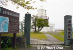
Rokkosaki Lighthouse is on the northern tip of Noto Peninsula in Ishikawa Prefecture. Built in July 1883 and designed by a British engineer named Richard Henry Brunton. It is also pronounced "Rokkozaki."Richard Henry Brunton (1841–1901) came to Japan in July 1868 to design lighthouses. He designed 26 lighthouses in Japan and was dubbed "Father of Japanese lighthouses".Jun 29, 2020
|
|
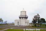
Rokkosaki Lighthouse is unmanned and normally closed to the public. A few times a year, it's open to the public. Stands on a cliff 50 meters above the sea.Many boats got lost or shipwrecked in this area until a bon fire was kept lit at night from the 18th century before this lighthouse was built. The light was first fueled by oil, then electricity in 1940.Jun 29, 2020
|
|
|
|
|
|
|