 Image search results - "Cape" Image search results - "Cape" |

Way to Cape Ayamaru lookout point.
|
|
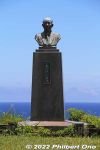
Bust of Nagano Yoshitatsu (1898–1984 永野芳辰) at Cape Ayamaru. Nagano was a Japanese government bureaucrat who helped to revert Amami islands back to Japan in 1953. He was born and raised on Amami Oshima. Later became governor of Kochi Prefecture.
|
|

Photo spot at Cape Ayamaru.
|
|
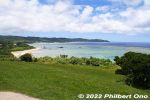
Cape Ayamaru scenery.
|
|
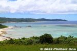
Northern coast of Amami Oshima as seen from Cape Ayamaru.
|
|
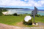
Cape Ayamaru sign and photo spot, Amami Oshima, Kagoshima.
|
|
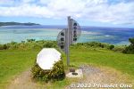
Cape Ayamaru sign and photo spot.
|
|
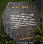
How Cape Ayamaru got its name.
|
|
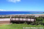
Lookout deck at Cape Ayamaru with views of the coral reef and ocean. Amami Oshima, Kagoshima.
|
|

Lookout deck at Cape Ayamaru shows a beautiful aqua-blue ocean.
|
|
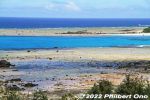
Lookout deck at Cape Ayamaru shows a beautiful aqua-blue ocean.
|
|
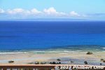
Lookout deck at Cape Ayamaru shows a beautiful blue ocean beyond the coral reef.
|
|
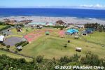
Recreational park down below from the lookout point on Cape Ayamaru.
|
|
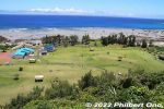
Recreational park down below from the lookout point on Cape Ayamaru.
|
|
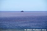
Tonbara Rock as seen from Cape Ayamaru. トンパラ岩
|
|
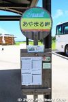
Local buses stop here too, not often though.
|
|
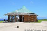
Gift shop.
|
|

Vestiges of the castle town remain here with white walls.
|
|

Traditional townscape in Hagi, Yamaguchi.
|
|

Front gate of Mori Clan's detached residence.
|
|
|
|
|
|

Nice traditional townscape in Hagi, Yamaguchi.
|
|

Mud wall of Toida Masuda residence.
|
|
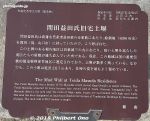
Mud wall of Toida Masuda residence.
|
|
|
|

Even modern homes have white walls.
|
|
|
|
|
|
|

This road goes to Hagi Museum.
|
|

The main kura storehouses here. 赤瓦二号館
|
|

The main Shirakabe kura storehouses in Kurayoshi, Tottori. 赤瓦二号館
|
|

The main Shirakabe kura storehouse in Kurayoshi, Tottori. 赤瓦二号館
|
|

The main Shirakabe kura warehouse in Kurayoshi, Tottori. 赤瓦二号館
|
|

The main Shirakabe kura warehouse in Kurayoshi, Tottori. 赤瓦二号館
|
|

The main Shirakabe kura warehouse in Kurayoshi, Tottori. 赤瓦二号館
|
|
|
|
|
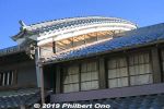
Mino in Gifu has a traditional townscape of "udatsu" homes. Udatsu is a decorative firewall on the side of the home's roof. Townscape is a rectangular area of residential streets lined with traditional homes. A few are open to the public.Near Minoshi Station on the Nagaragawa Railway. This area is a National Important Traditional Townscape Preservation District (重要伝統的建造物群保存地区).
|
|
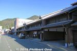
Mino and this townscape was part of the Mino castle town developed by Daimyo Kanamori Nagachika (1524–1608) who lived in nearby Ogurayama Castle. You can park your car somewhere and walk around the area.National Important Traditional Townscape Preservation District.
|
|
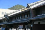
Mino basically developed as a merchant's town up to the late 19th century. Udatsu roof firewall in Mino, Gifu.
|
|
|
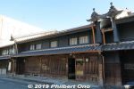
Hirata Family residence 平田家
|
|

Signboards explain in English the most significant homes. This is the Hirata Family residence.
|
|
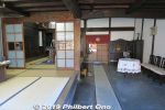
Inside Hirata Family residence
|
|
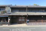
Former Honjin lodge for VIPs. Suzuki Kohei residence.
|
|

About Suzuki Kohei residence.
|
|
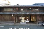
Kosaka Family Residence of a sake brewing family. National Important Cultural Property. 小坂家住宅
|
|
|
|
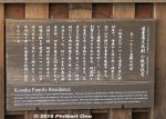
About Kosaka Family Residence. 小坂家住宅
|
|
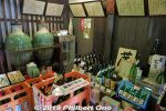
Inside Kosaka Family Residence is a sake shop.
|
|
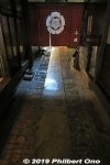
Kosaka Family Residence
|
|
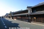
Udatsu roofs in Mino, Gifu Prefecture.
|
|
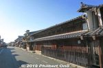
Yoshida Kobo
|
|

Yoshida Kobo
|
|
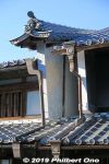
Yoshida Kobo udatsu roof firewall.
|
|
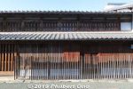
Former Imai Residence 旧今井家
|
|
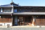
Former Imai Residence used as the Mino History Museum. Free admission.
|
|

About Former Imai Residence. 旧今井家
|
|
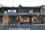
Tomiya
|
|
|
|
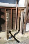
Markers commemorating a visit by the Emperor and Empress and Crown Prince.
|
|
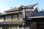
Udatsu roof firewall in Mino, Gifu.
|
|
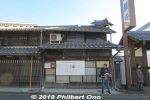
Juroku Bank
|
|

Sign about Sugihara Chiune who was born in Mino, Gifu near here. Sugihara is famous as the Japanese diplomat in Lithuania who gave transit visas to Jews fleeing the Holocast during World War II.
|
|

Sign about Sugihara Chiune who was born in 1900 at Kyosenji Temple in Mino, Gifu near here. 杉原 千畝
|
|
|
|
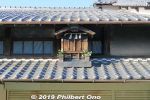
Little external shrine, Akiba-sama. 秋葉様
|
|

Matsuhisa Eisuke paper store
|
|
|
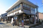
Mino Tourist information office has tourist pamphlets. 美濃市観光協会「番屋」
|
|
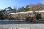
Also visited Ogurayama Castle on a hilltop nearby. 小倉山城跡
|
|
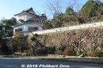
Ogurayama Castle on a hilltop. Originally built by Kanamori Nagachika (1524–1608) 金森長近 in 1605 as a retirement residence. Now part of Ogura Park in Mino, Gifu Prefecture. 小倉山城跡The turret is a reconstruction.
|
|
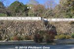
Ogurayama Castle on a hilltop. Kanamori Nagachika (1524–1608) was a daimyo who developed the Mino castle town. 小倉山城跡
|
|
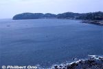
Manazuru Peninsula is a small, scenic spit of rocky and hilly land jutting into Sagami Bay, western Kanagawa. The forest on the peninsula is one of Japan's Top 100 Forests (森林浴の森100選) as designated by Japan's Forestry Agency.
|
|
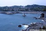
The bridge going to Manazuru Peninsula is on Route 135.
|
|
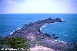
The tip of Manazuru Peninsula has this slim, rocky shoal called Cape Manazuru (真鶴岬).
|
|

At low tide, you can walk to Cape Manazuru whose tip has Mitsu-ishi (三ツ石) or Rock Trio.
|
|

Cape Manazuru tip with Mitsu-ishi (三ツ石) or Rock Trio. Two of the pointy rocks are bound by a shimenawa sacred rope. It's a noted spot for watching the New Year's first sunrise which rises between the two roped rocks.
|
|

Mitsu-ishi (三ツ石) rocks bound by a shimenawa sacred rope.
|
|

Fishing boat sailing past Manazuru Peninsula.
|
|
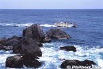
Fishing boat sailing past Manazuru Peninsula.
|
|
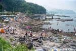
Manazuru Peninsula is also a popular scuba diving spot (Kotogahama), especially for beginner divers training to receive their diving license. Divers can just enter the water from shore, no need for a boat. Cars can also be parked nearby.
|
|

Scuba divers taking a break on shore at Manazuru Peninsula. Stoney shore, no sandy beach.
|
|

Scuba diving at Manazuru Peninsula. We went down as deep as 20 meters.
|
|

Scuba diving at Manazuru Peninsula. Lots of seaweed on the bottom.
|
|

School of small fish. Most of my underwater photos were shot too close and came out blurry.
|
|
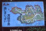
Old map of Manazuru Peninsula.
|
|
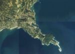
Aerial photo of Manazuru Peninsula from 1983. Cape Manazuru is clearly visible.Copyright © National Land Image Information (Color Aerial Photographs), Ministry of Land, Infrastructure, Transport and Tourism
|
|
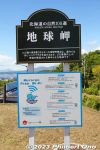
Cape Chikyu (also spelled Chikiu) is on the southernmost tip of Muroran on Etomo Peninsula, making it a popular spot to see the sunrise especially on New Year's Day. It overlooks the deep blue Pacific Ocean.
|
|
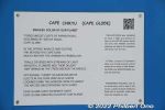
Poem about Cape Chikyu. Although the original name is Chikiu (チキウ岬) coming from the Ainu word "Chikepu" (チケプ) meaning cliff. It has been Japanized into "Chikyu" (地球) meaning Earth.
|
|
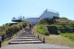
Cape Chikyu has a lookout deck. From JR Bokoi Station, 35-min. walk or 10-min drive. By bus, get off at the Chikyu-Misaki Danchi stop.
|
|
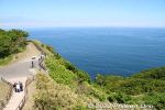
View from Cape Chikyu.
|
|
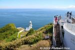
Lookout deck on Cape Chikyu, one of Hokkaido's Top 100 scenic spots. "Chikiu" comes from the Ainu word "Chikepu" (チケプ) meaning cliff. The name morphed into Chikiu (チキウ), and then "Chikyu" (地球) meaning Ear
|
|
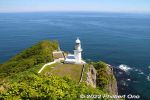
On Cape Chikyu is the Cape Chikiu Lighthouse built in 1920. One of Japan's Top 50 Lighthouses. チキウ岬灯台
|
|
|
|
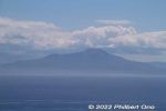
Across the bay is Hakodate.
|
|
|
|
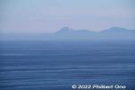
Mt. Usu in the Lake Toya area can be seen.
|
|
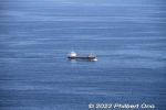
If you're lucky, you might see whales and dolphins.
|
|
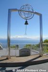
Bell of Happiness on the lookout deck.
|
|
|

About Cape Chikyu in Japanese.
|
|
|
|
|
|
|

About Cape Chikiu Lighthouse.
|
|
Photo op.
|
|
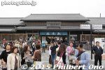
Sawara is a National Important Traditional Townscape Preservation District (重要伝統的建造物群保存地区) along the Ono River near JR Sawara Station (Narita Line).
|
|
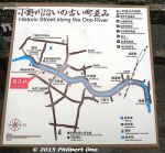
Map of the traditional townscape along the Ono River. I started from the Kaiun Bridge on the right of this map.
|
|
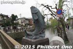
Leaping carp or maybe sea bream.
|
|
|
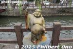
Ono River has these little statues of the Gods of Good Fortune. Sawara, Katori, Chiba.
|
|
|
|
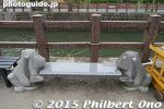
Bench
|
|
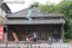
A few buildings were in need of repair.
|
|
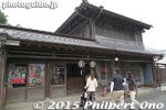
Sake merchant
|
|
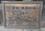
Sake merchant
|
|
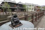
Sawara, Katori, Chiba
|
|
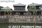
Traditional townscape in Sawara, Katori, Chiba Prefecture.
|
|
|
|
|
|
|
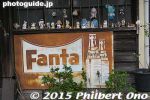
Sawara has some old signs like this one for Fanta soda.
|
|
|
|
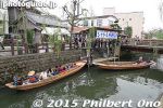
Traditional boat rides on Ono River operated by cute grandmas.
|
|
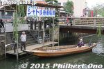
Shuttle boats (¥1,300 roundtrip) and tour boats (¥500) are busy on Ono River during the spring and autumn festival time.
|
|
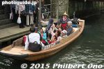
Traditional boat rides on Ono River.
|
|
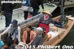
Traditional boat rides on Ono River.
|
|
|
|
|
|
|
|
|
|
|
|
|
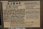
About the Shojo Soy Sauce Shop established in 1800.
|
|
|
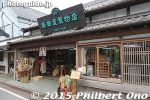
Uedaya Hardware Store
|
|
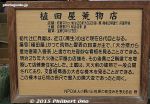
About Uedaya Hardware Store founded by a merchant from Gamo, Shiga Prefecture. Still in business.
|
|
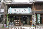
Tobacco and Tea Shop
|
|
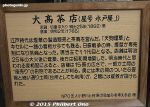
About the Tobacco and Tea Shop
|
|
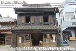
Traditional townscape in Sawara, Katori, Chiba Prefecture.
|
|
|
|
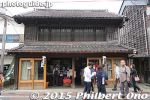
Oil merchant
|
|
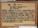
About the oil merchant
|
|
|
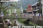
Jaja Bridge
|
|
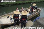
Boat dock at the other end of the river.
|
|
|
|
|
|
|

About Kinsei Japanese textile shop
|
|
|
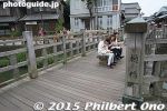
Jaja Bridge (Toyohashi Bridge) in Sawara, Chiba.
|
|
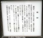
About Jaja Bridge (Toyohashi Bridge) in Sawara, Chiba.
|
|
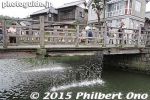
Jaja Bridge (Toyohashi Bridge) in Sawara, Chiba has a waterfall.
|
|
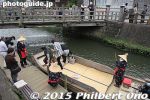
Boat dock for boat rides on Ono River.
|
|
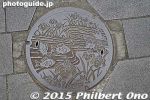
Manhole in Sawara, Katori, Chiba. River fish and irises.
|
|
|
|
|
|

About Sawara's traditional townscape.
|
|
|
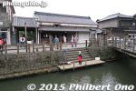
Ino Tadataka's former residence in Sawara, Chiba is open to the public.
|
|

Open hours of Ino Tadataka's former residence.
|
|

Ino Tadataka was a geographical surveyor who was the first to use modern scientific surveying methods to produce very accurate maps of Japan known as Inoh maps.
|
|
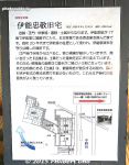
Layout of Ino Tadataka's former residence.
|
|
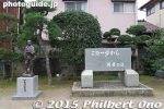
Monument for Ino Tadataka at his former residence.
|
|
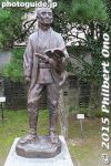
Statue of Ino Tadataka at his former residence.
|
|
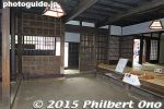
Inside the entrance foyer of Ino Tadataka's former residence. Japanese-style home.
|
|
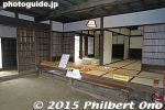
Ino Tadataka's former residence is quite spacious.
|
|

Ino Tadataka's former residence
|
|
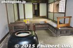
Ino Tadataka's former residence
|
|
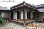
Ino Tadataka's former residence
|
|
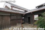
Ino Tadataka's former residence
|
|
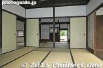
Ino Tadataka's former residence
|
|
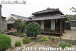
Ino Tadataka's former residence
|
|
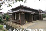
Ino Tadataka's former residence
|
|
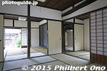
Ino Tadataka's former residence
|
|
|
|
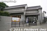
Ino Tadataka Memorial Hall, a local museum. Photography was not allowed inside.
|
|
|
|

Drive further around Sakieda Peninsula and see Ishigaki Cape Ogansaki Lighthouse. Built in March 1983. 石垣御神埼灯台
|
|

Cape Ogansaki 御神埼
|
|

Cape Ogansaki 御神埼
|
|

Cape Ogansaki 御神埼
|
|

Cape Ogansaki 御神埼
|
|

Cape Ogansaki 御神埼
|
|

On Cape Ogansaki, memorial for the 35 people who died in the Yaeyama Maru that was shipwrecked on Dec. 8, 1952 off this coast. 御神埼Monument was built in Dec. 1976.
|
|
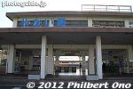
Central Yanai has a beautiful street of traditional buildings having traditional white walls (shirakabe). This area is also a National Important Traditional Townscape Preservation District (重要伝統的建造物群保存地区).
|
|
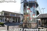
The white-walled street is called Shirakabe Machinami (白壁の町並み), a short walk from JR Yanai Station.
|
|
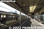
Train platform at JR Yanai Station.
|
|
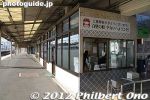
JR Yanai Station.
|
|
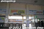
Inside JR Yanai Station.
|
|

Map of central Yanai.
|
|
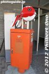
The goldfish is the symbol of Yanai, Yamaguchi. Here's on atop a mailbox.
|
|
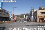
Road in front of JR Yanai Station. Walk straight on this road to the white-walled street.
|
|
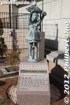
A few scupltures along the road to the white-walled street. Yanai, Yamaguchi
|
|

Directional signs in English.
|
|
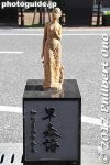
Yanai, Yamaguchi
|
|
|

About Yanai's white-walled street.
|
|
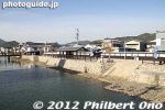
Cross the river.
|
|
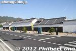
First you see Muroya-no-Sono, a longhouse museum.
|
|
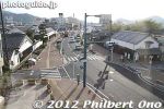
Street heading to JR Yanai Station.
|
|
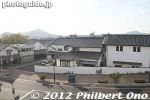
Entrance to the white-walled street. Even the private home on the right is white.
|
|

Private home blending in with the white-walled street in Yanai, Yamaguchi.
|
|
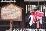
Sign indicating that this area is an Important Traditional Townscape.
|
|

About Yanai's goldfish connection.
|
|
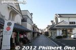
Walking along Yanai's white-walled street.
|
|
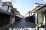
Yanai's white-walled street has a long history going back to the Muromachi Period (1337-1573). It used to be a merchant quarter. The street is about 200 meters long.
|
|
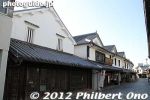
Buildings are beautiful and in unison. Very impressive. Most buildings are private, but there are a few tourist shops and homes open to the public.
|
|
|
|
|
|
|
|
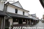
This is the Kunimori family home, open to the public. Important Cultural Property. Admission 200 yen. Yanai, Yamaguchi Prefecture.
|
|
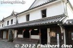
The Kunimori home is a former merchant's home. Open 9 am - 5 pm. Closed Mon.
|
|
|

About the Kunimori merchant's home.
|
|
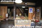
Inside the Kunimori-ke merchant's home.
|
|
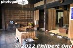
The Kunimori merchant's home is large and spacious. You can see how Edo Period merchants lived.
|
|
|
|
|
|
|
|
|
|
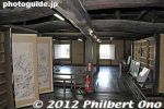
2nd floor of Kunimori merchant's home.
|
|
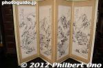
Folding screen
|
|
|
|
|
|
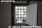
Window on the 2nd floor of Kunimori merchant's home..
|
|
|
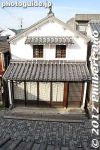
Yanai, Yamaguchi
|
|
|
|