 Image search results - "date" Image search results - "date" |

Waste vegetable oil collection box sign.
|
|

One supermarket in Date, Hokkaido which has a waste vegetable oil collection box.
|
|

Near the entrance of the supermarket is the waste vegetable oil collection box.
|
|

Waste vegetable oil collection box with a few plastic bottles of waste oil left by customers.
|
|

A worker from Date Cosmos 21 comes to collect the waste oil.
|
|

Other waste oil containers.
|
|

This small building next to the Date Cosmos 21 Center is a waste oil conversion plant.
|
|

Waste oil tanks, each holding 1000 liters. The waste oil is first filtered.
|
|

The waste oil is fed to the conversion plant.
|
|

Through a chemical process, the waste oil is converted to biodiesel fuel.
|
|

Glycerine is removed from the waste oil.
|
|

The biodiesel fuel goes into this barrel.
|
|

The plant's control panel.
|
|

Bottles showing the waste oil conversion process from left to right.
|
|

Biodiesel fuel tank connected to a gas pump.
|
|

Filling up the gas tank with biodiesel fuel.
|
|

The non-toxic auto exhaust smells like tempura.
|
|

JR Date-Mombetsu Station on the Muroran Line. Date's main train station. 伊達紋別駅
|
|

Inside JR Date-Mombetsu Station
|
|

Date: Town of Bushido. Warrior's helmet on JR Date-Mombetsu Station train platform. The city has a samurai past.
|
|

JR Date-Mombetsu Station overpass
|
|

JR Date-Mombetsu Station stairs have wood.
|
|

JR Date-Mombetsu Station overpass. The station has a certain weathered, rustic charm.
|
|

JR Date-Mombetsu Station stairs to the train platform.
|
|

JR Date-Mombetsu Station train platform.
|
|

Train at JR Date-Mombetsu Station
|
|

Street corner sculpture of a couple in love. Perhaps in reference to a romantic "date."
|
|

Bus stop in central Date.
|
|

Bus for Toyako Onsen Spa. They don't run that often, but are more convenient than a train if you want to go to Lake Toya.
|
|

Donan Bus company provides bus service in this area. 道南バス
|
|
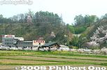
Date Onsen Spa and cherry blossoms. There is a hot spring lodge with 58 rooms and a sauna. Reasonable rates. Non-guests can bath in the hot spring for 390 yen. Phone: 0142-25-1919
|
|
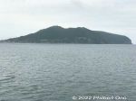
Approaching Hakodate with Mt. Hakodate in view.
|
|
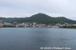
Approaching Hakodate Port with Mt. Hakodate in view.
|
|
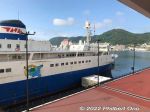
Hakodate Port's Wakamatsu Dock where cruise ships dock next to the Mashu Maru museum ship.
|
|
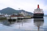
Hakodate Port's Wakamatsu Dock where cruise ships dock.
|
|
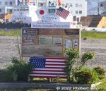
Monument for Commodore Perry's visit to Hakodate.
|
|

Map of Hakodate.
|
|

Map of the area around JR Hakodate Station.
|
|
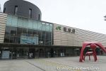
JR Hakodate Station is right next to Hakodate Port because train ferries used to dock and bring the trains to the station.
|
|
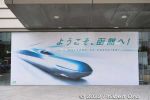
Hokkaido Shinkansen does not stop at JR Hakodate Station. It stops at Shin-Hakodate-Hokuto Station slightly north. Also stops at Kikonai Station slightly south.
|
|
|
|
|
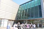
JR Hakodate Station entrance.
|
|
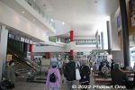
Inside JR Hakodate Station.
|
|
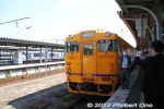
South Hokkaido Railway (Donan Isaribi Railway) going to JR Kikonai Station (end of the line) and shinkansen station.
|
|
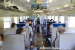
Inside the South Hokkaido Line train.
|
|
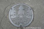
Hakodate manhole with a cuttlefish design.
|
|
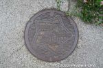
Hakodate manhole with a Goryokaku Castle design.
|
|
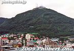
Hakodate's main attraction and landmark is Mt. Hakodate-yama, accessible by ropeway.
|
|
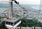
Going up Hakodate-yama, Hakodate, Hokkaido.
|
|
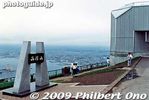
Hakodate-yama
|
|
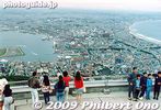
Lookout deck on Hakodate-yama.
|
|

A bird's eye view of Hakodate from Hakodate-yama. The city is pretty compact. Easy to tour on bicycle.
|
|

At night from Hakodate-yama is the Million-Dollar View.
|
|

Hakodate Port
|
|
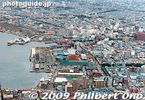
Hakodate Port
|
|

Fireworks as seen from Hakodate-yama. The fireworks were part of the annual Hakodate Minato (Port) Matsuri festival in early Aug.
|
|
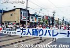
Hakodate Minato (Port) Matsuri parade
|
|
|
|
|
|
|
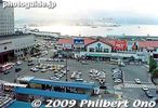
Old Hakodate Station. A new station was built in 2003.
|
|

Old Hakodate Station.
|
|
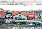
Old Hakodate Station.
|
|
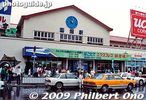
Old Hakodate Station.
|
|

Mashu Maru, a ferry which plied between Hakodate and Aomori.
|
|
|

Hakodate Morning Market
|
|
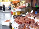
Morning Market. Photo by Hokkaido Tourist Organization.
|
|
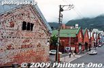
Hakodate Red Brick Warehouses
|
|
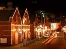
Hakodate Red Brick Warehouses at night. Photo by Hokkaido Tourist Organization.
|
|
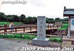
Goryokaku Castle Park
|
|

Goryokaku Castle Park
|
|

Goryokaku Castle Park. Frustrating that you cannot photograph the entire star-shaped castle. Unless you're in an airplane.
|
|
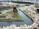
Photo by Hokkaido Tourist Organization.
|
|

Sea gulls in Hokkaido all face the same direction. They must be Japanese birds who like to conform to the group.
|
|
|
|
|
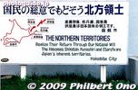
Give back the Northern Territories
|
|

Date is pronounced "DAH-tay." The city of 37,000 was founded in 1870 by a samurai named Date Kunishige and his vassals and citizens who migrated from Sendai, Miyagi Prefecture. Thus, you will find occasional references to the samurai in Date. �
|
|

Date Rekishi no Mori is a large park with various public facilities including a Japanese garden. The park was completed in 2000 after about 11 years of construction. This is the castle-like Otemon Gate built when the Crown Prince got married in 1993.
|
|

Although the park is designed like a castle grounds with a castle wall and moat, it is not the site of any former castle.
|
|

The park includes a culture center, public library, sports ground, and the Kaitaku Kinenkan museum.
|
|
|

Reconstructed castle wall and cherry blossoms.
|
|

The park has a number of buildings. This is the tourist gift shop and hands-on workshop for swordmaking and fabric dyeing.
|
|

Map of Date Rekishi no Mori. Various festivals and events are also held in the park. Unfortunately, I didn't have time to see everything in the park.
|
|

Rest House
|
|

Rest House windows
|
|

Entrance to the swordsmith and fabric dyeing workshop. You can see a swordsmith making a sword. You have to check when he's doing it though. Free admission. Web site 黎明観
|
|

Miyao Tomiko Literature Museum. Admission 120 yen. Unfortunately, I didn't have time to enter it. 宮尾登美子文学記念館
|
|

One of the main attractions of the park is the Geihinkan State Guesthouse. Cherry blossoms were in full bloom.
|
|

Geihinkan Guesthouse and cherry blossoms. 迎賓館
|
|

Plum blossoms and cherry blossoms in the background, blooming at the same time.
|
|

Cherry blossoms next to the Geihinkan were beautiful in early May.
|
|
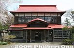
Geihinkan Guesthouse in Date Rekishi no Mori park, Hokkaido. Two-story wooden structure built in 1892 during the Meiji Period. 迎賓館
|
|

The Geihinkan was used to receive high-ranking government officials visiting Date to inspect the development of the town. 迎賓館
|
|

On display on the first floor were samurai armor.
|
|

Samurai armor displayed on the first floor veranda of the Geihinkan.
|
|
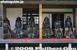
Samurai armor displayed on the first floor veranda of the Geihinkan.
|
|

Samurai armor displayed on the first floor veranda of the Geihinkan.
|
|

Samurai armor displayed on the first floor veranda of the Geihinkan.
|
|

Western-style room inside the Geihinkan.
|
|

Japanese-style room on 2nd floor of the Geihinkan.
|
|

2nd floor of the Geihinkan.
|
|

2nd floor of the Geihinkan.
|
|

2nd floor corridor of the Geihinkan.
|
|

Near the Geihinkan is the Date Kaitaku Kinenkan Museum (opened in 1958) displaying swords, lacquerware, etc., from the Date samurai clan, donated to the city by the Date family. Photography is not allowed inside the museum. Closed Dec.-Feb. 伊達市開�
|
|

Behind the Date Kaitaku Kinenkan Museum is the former Mitobe house on display. It is a typical house of the first settlers of Date, Hokkaido. Based on Sendai-style (Miyagi Pref.) architecture. Important Cultural Property. 旧三戸部家住宅
|
|
|

Inside Mitobe house with a hearth.
|
|
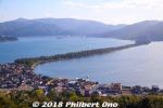
Amanohashidate is northern Kyoto's main attraction and very famous for centuries as one of Japan's Scenic Trio (Nihon Sankei 日本三景). The other two in the scenic trio are Miyajima (vermillion torii and shrine on the ocean) in Hiroshima and Matsushima (pine tree islands) near Sendai, Miyagi Prefecture. It's about 3.6 km long, totally flat, and you can cross it on foot or by bicycle (rentals available) on a dirt road in the middle. The road is lined with thousands of Japanese pine trees and closed to vehicular traffic. This view is from the northern end atop Kasamatsu Park. Near Amanohashidate Station.
|
|
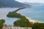
The thing about Amanohashidate is that it looks very different from different lookout points. The most popular spots to view Amanohashidate are on the hilltop on the southern end and northern end.If you have time, I highly recommend that you see it from both the southern end and northern ends. Which means you should rent a bicycle and ride across Amanohashidate.
This is from the hilltop on the southern end, from a small amusement park called Amanohashidate Viewland easily accessible via chair lift or cable car, and a short walk from Amanohashidate Station. Map: https://goo.gl/maps/yNhxjwK2ocz
This southern end connects to mainland Japan, so what you see in the distance is Tango Peninsula up north.
The left side is the west side with an enclosed, but connected ocean named Asoumi Sea. The right side is the east side with white-sand beaches facing the open ocean. Ships can still go through both sides of the sandbar through a narrow strait on the southern end.
The greenery area on the lower left facing the sandbar is Chionji Temple.
|
|
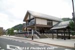
Amanohashidate Station (Kyoto Tango Railway, nicknamed "Tantetsu" or "Willer Trains") is close to Amanohashidate sandbar. Trains from JR Osaka, Kyoto, and Fukuchiyama Stations stop here.
|
|

What to see from Amanohashidate Station. Best to rent a bicycle at the souvenir shop in front of the station.
|
|
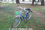
My rental bicycle. Rental bicycles also available at the entrance to the Amanohashidate sandbar.
|
|
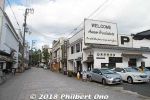
Near the entrance to Amanohashidate, this welcome sign with "One of the three famous beauty spots of Japan" has been here for decades.According to Japanese Wikipedia, the "Nihon Sankei" (Japan's Scenic Trio) label originated in 1643 by Hayashi Gaho (aka Hayashi Shunsai), a Japanese Neo-Confucian scholar who wrote a book mentioning these three sights. The expression "Nihon Sankei" was later coined in 1689 by another Japanese Neo-Confucianist scholar, Kaibara Ekken in his travel diary. So "Nihon Sankei" goes way back to the 17th century.
It's really amazing that it has stuck throughout these centuries even with Mt. Fuji not included. With Japan having so many places of beauty, it would be nearly impossible today for anyone to unilaterally declare any three sights as the "Best Three."
To the question of why it's always the best "three," the answer seems to be more complicated. It seems the Japanese have had numerical favorites for many centuries. Many odd numbers are favorites including one, three, five, and seven. This might sound familiar when you think about haiku and tanka poetry syllables, and the 7-5-3 coming of age celebration for kids. But the number "three" for "Best Three" has also stuck for centuries and still today.
|
|
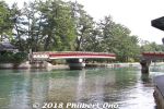
On the southern end, this bridge to Amanohashidate rotates quite often to allow boats to pass.
|
|
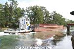
Most of the boats carry freight.
|
|
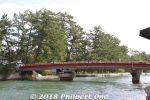
Rotating bridge for pedestrians again.
|
|
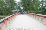
Rotating bridge for Amanohashidate.
|
|
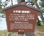
About the rotating bridge (Shotenkyo).
|
|

Sightseeing map of Amanohashidate.
|
|
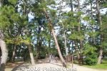
Entrance to Amanohashidate's path to the other end. Japanese pine trees all over on both sides of the road.
|
|

How Amanohashidate sandbar formed. Sand from the east coast of Tango Peninsula carried by ocean currents were repeled by the river current of the Noda River. The sand thereby accumulated from the northern end to enclose the bay.Underwater, Amanohashidate looks like a sand wall.
|
|
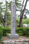
Amanohashidate marker.
|
|
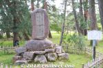
Monument for Emperor Showa's Amanohashidate poem he wrote when he visited this area in 1951.
|
|

Emperor Showa's Amanohashidate poem.
|
|
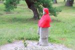
Jizo statue on Amanohashidate.
|
|
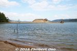
Amanohashidate's finger of sand that keeps growing. Every few years, they have to remove the excess sand, otherwise it will become another sandbar impeding shipping.
|
|
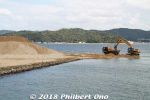
Amanohashidate's finger of sand that keeps growing. Every few years, they have to remove the excess sand, otherwise it will become another sandbar impeding shipping.
|
|
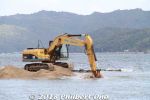
The sand spit gets shorter each hour.
|
|
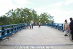
The bridge to Amanohashidate.
|
|
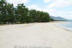
Beach on the east side of Amanohashidate.
|
|
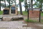
Amanohashidate poetry monument for famous travel poet Yosano Akiko and husband Yosano Tekkan. 与謝野 鉄幹(与謝野 寛)、与謝野 晶子
|
|

About Amanohashidate's pine trees.
|
|

Wild birds found at Amanohashidate. They only wrote the scientific names of the birds. Looks like they include the seagull, egret, heron, sparrow, and cormorant.
|
|
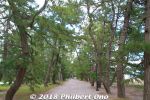
Cycling on Amanohashidate through thousands of Japanese pine trees. It takes 10-15 min. by bicycle without stopping. But there are a number of monuments, shrine, commemorative pine trees, and beaches to photograph along the way. So it took me 30-40 min.
|
|
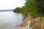
West side of Amanohashidate with no beaches.
|
|
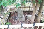
Swordsman Jutaro Iwami's testing stone.
|
|

About swordsman Jutaro Iwami's testing stone.
|
|
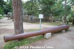
Would you believe a cannon on Amanohashidate?
|
|

The cannon was never based or used on Amanohashidate. It was originally from the Battleship Kasuga. Donated by the Imperial Navy to the village in 1923 to promote the Imperial Navy.
|
|
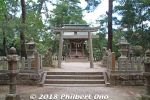
Near the cannon is Amanohashidate Shrine.
|
|
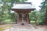
Amanohashidate Shrine
|
|

About Amanohashidate Shrine.
|
|
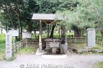
Near Amanohashidate Shrine is this well of pure spring water named "Iso-shimizu" (磯清水) famous since the Heian Period.
|
|

About "Iso-shimizu" (磯清水).
|
|

About "Iso-shimizu" (磯清水) well.
|
|
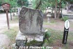
Poetry monument for Buson, a famous poet.
|
|

About Buson, a famous poet.
|
|
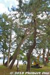
Many pine trees have names.
|
|
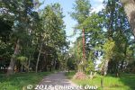
Path on Amanohashidate going north. Almost endless forest of pine trees. Very pleasant cycling ride or walk.
|
|
|
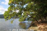
West side of Amanohashidate.
|
|
|
|
|
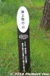
Marker for Emperor Taisho's visit. Anybody who is a somebody has visited Amanohashidate.
|
|
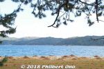
The ocean and beach.
|
|
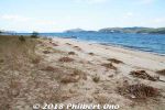
This part of the beach had many little piles of driftwood which they were cleaning up.
|
|
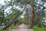
A few pine trees died or were knocked down.
|
|
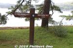
Good to know how far away you are.
|
|
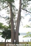
Wedded pine trees on Amanohashidate. (夫婦松)
|
|
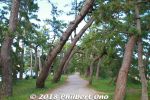
Wind-blown pine trees.
|
|
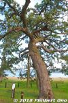
Pine tree for the sawn maiden's clothes. 羽衣の松
|
|
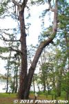
Looks like another wedded pair of pine trees, but it is named "Good Friends pine trees." なかよしの松
|
|
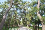
Don't ever get tired of the scenery.
|
|
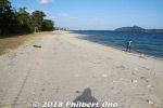
Sunny beach on Amanohashidate.
|
|
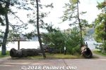
The Twin Dragon Pine Trees were broken. 双龍の松
|
|
|
|

East edge of Amanohashidate looking toward Kasamatsu Park on the hill.
|
|
|
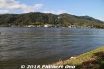
East edge of Amanohashidate looking toward Kasamatsu Park on the hill.
|
|
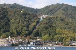
Kasamatsu Park on the hill as seen from Amanohashidate.
|
|
|
|
|
|
|
|
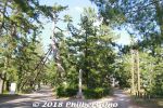
Fork in the road. Go left.
|
|
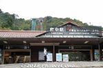
Fuchu Station is the Cable Car and Chair Lift station to go up to Kasamatsu Park on the northern end of Amanohashidate.
|
|
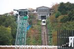
Cable Car and Chair Lift station to go up to Kasamatsu Park.
|
|
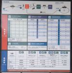
Time schedule and fares for Cable Car and Chair Lift. The chair lift runs non-stop so it's faster than waiting for the next cable car.
|
|
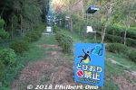
If you're not afraid of heights, take the chair lift. They keep telling you not to jump off even if you dropped something.
|
|
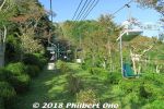
Chair lift to Kasamatsu Park.
|
|
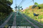
Chair lift to Kasamatsu Park.
|
|
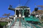
Arriving Kasamatsu Park on the chairlift.
|
|
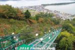
Chair lift to Kasamatsu Park.
|
|
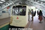
Cable car if you're afraid of heights.
|
|
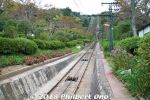
Cable car to Kasamatsu Park.
|
|

Cable car to Kasamatsu Park.
|
|
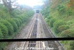
Cable car to Kasamatsu Park.
|
|
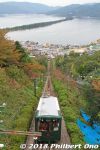
Cable car to Kasamatsu Park.
|
|
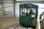
Arriving Kasamatsu Park on cable car.
|
|
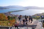
Amanohashidate as seen from the northern end atop Kasamatsu Park.Amanohashidate is a sandbar created since thousands of years ago by opposing ocean currents carrying sand. According to Japanese mythology, Amanohashidate was created during the age of gods (before man appeared). The great god Izanagi in Heaven, built a long floating ladder-bridge from Heaven to Earth so he could see his wife the goddess Izanami who was living at Moto-Ise Kono Shrine on Earth. However, in a single night while he was asleep, the bridge collapsed and fell to Earth, where Amanohashidate is today. And so if you view it upside down at Kasamatsu Park, it's supposed to look like a bridge to heaven which is what "Amanohashidate" means.
|
|
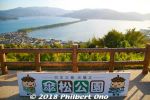
Amanohashidate as seen from the northern end atop Kasamatsu Park.
|
|
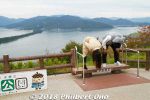
Look at Amanohashidate upside down.
|
|
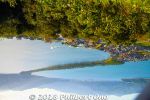
Upside down, it supposed to look like a bridge to heaven.
|
|
|
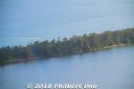
Closeup of Amanohashidate.
|
|
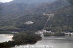
Southern end of Amanohashidate. Amanohashidate Viewland can be seen.
|
|
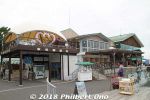
Kasamatsu Park has the usual touristy restaurants and shops. Nice benches and no amusement park.
|
|
|
|
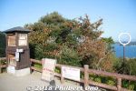
Another Ring of Wisdom on Kasamatsu Park.
|
|
|
|
|
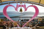
And so Amanohashidate symbolizes a link between Heaven and Earth and between two lovers. That's why you may also see heart or love symbols at Amanohashidate.
|
|
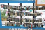
Padlocks for lovers.
|
|
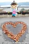
Autumn heart at Amanohashidate.
|
|

How Amanohashidate was formed, according to mythology.
|
|
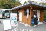
Bus stop to Nariaiji temple further up the hill, one of the 33 Saigoku Kannon Pilgrimage Temples.
|
|
|
|
|
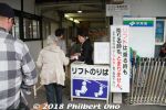
Entrance to chair lift to go down from Kasamatsu Park.
|
|
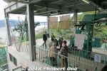
Chair lift to go down from Kasamatsu Park.
|
|
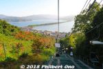
Chair lift down from Kasamatsu Park has nice views.
|
|
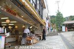
Souvenir shops near the chair lift station at Fuchu Station.
|
|
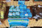
Amanohashidate sardines supposed to be good.
|
|

Old postbox and a message.
|
|
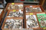
Puffer fish.
|
|
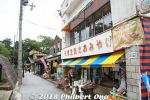
Path to nearby Moto-Ise Kono Shrine is lined with souvenir shops.
|
|
|
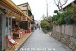
Path to nearby Moto-Ise Kono Shrine.
|
|

Moto-Ise Kono Shrine (元伊勢籠神社)Ise Grand Shrines (Ise Jingu) in Mie Prefecture are Japan's most sacred Shinto shrines. They are dedicated to the Sun Goddess Amaterasu (Shinto's most important goddess and legendary ancestor of the Imperial family) and Toyouke-Omikami (豊受大神), goddess of agriculture.
|
|
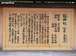
About Moto-Ise Kono Shrine (元伊勢籠神社). Before Ise Jingu was established around the 7th century (or earlier), a number of shrines for these two deities were temporarily or permanently established in various locations including this Kono Shrine. These pre-Ise Jingu shrines are prefixed with "Moto-Ise." Kono Shrine worships five gods and one of them is Toyouke-Omikami (豊受大神), the same goddess of agriculture worshiped in Ise.
|
|
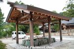
Purify yourself here.
|
|
|

Moto-Ise Kono Shrine torii. No photos beyond this torii.
|
|
|
|
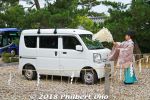
Lucky to see a shrine priest bless a vehicle for traffic safety.
|
|
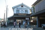
Boat dock on the northern end to cross by boat if you don't want to cycle.
|
|
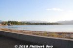
Amanohashidate
|
|
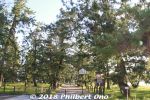
Entrance to Amanohashidate's northern end.
|
|
|
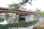
After bicycling across Amanohashidate back to the southern end, the rotating bridge again making room for a ship.
|
|
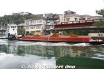
Ship coming through.
|
|
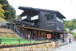
Chair lift and cable car station for Amanohashidate Viewland. Short walk from Amanohashidate Station.
|
|
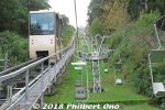
Chair lift and monorail car for Amanohashidate Viewland. Taking the chair lift is faster than the monorail car.
|
|
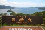
Amanohashidate from Amanohashidate Viewland (southern end).
|
|
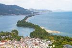
Amanohashidate as seen from the southern end atop Amanohashidate Viewland.
|
|
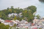
Chionji Temple
|
|
|
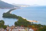
On the lower right of the sandbar, notice the finger of sand extending into the ocean. This finger keeps growing as the northern sand erodes and drifts over to it. So every few years, they have to remove the excess sand. (Notice the power shovel and dump truck working on it.) Otherwise, this little sand spit will become another sandbar across the ocean, impeding local shipping.
|
|
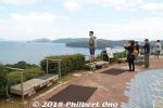
Platforms where you supposed to view the sandbar upside down.
|
|
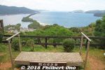
Platform to view the sandbar upside down.
|
|
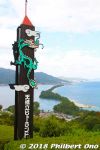
On the southern end here, Amanohashidate upside down looks like a flying dragon (hiryu 飛竜).
|
|

On the southern end here, Amanohashidate upside down looks like a flying dragon (hiryu 飛竜).
|
|
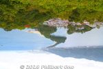
That's the dragon's head in the front and the slim tail in the back. When you see it upside down, the sandbar/dragon is in the sky right?
|
|
|
|