 Last additions - Otsu 大津市 Last additions - Otsu 大津市 |

Cheering/coaching from bicycleJul 13, 2006
|
|
Starting lineJul 13, 2006
|
|

Kyoto Univ. comes in 3rd placeJul 13, 2006
|
|

Starting line staffJul 13, 2006
|
|

Kyoto University's cheering section for the 8-man raceComplete with cheerleaders.Jul 13, 2006
|
|

Eight-man raceJul 13, 2006
|
|
Jul 13, 2006
|
|

High school spectators near the finish lineJul 13, 2006
|
|

Off they goJul 13, 2006
|
|

Cheering sectionJul 13, 2006
|
|
Four-man race starts with the cox at the front.Jul 13, 2006
|
|
Close-up of rowers at Asahi RegattaJul 13, 2006
|
|

Starting line. The man says "Yoi" (Ready) then "Go."「用意」、次いで「ゴー」Jul 13, 2006
|
|
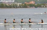
Four-man race with the cox at the sternJul 13, 2006
|
|

Cheering section for NagahamaJul 13, 2006
|
|
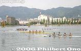
Four-man boat race. There were also foreign rowers from international schools.Jul 13, 2006
|
|

Azaleas in full bloom along the lake edgeJul 13, 2006
|
|

Rowing team from NagahamaJul 13, 2006
|
|

Race course at the head of Seta River where it meets Lake Biwa. 1000-meter course with 6 lanes.Jul 13, 2006
|
|

Carrying back a single sculling boatJul 13, 2006
|
|

The place was not as crowded as you would think.Jul 13, 2006
|
|

Being my first regatta, I was at first daunted by the rowing terminology for the different types of boats.Jul 13, 2006
|
|

Sleek racing row boats and traditional yakata picnic boats on upper rightJul 13, 2006
|
|

Singing "Lake Biwa Rowing Song" (Biwako Shuko no Uta)Jul 11, 2006
|
|

Truck to carry the boatsJul 11, 2006
|
|

Singing "Lake Biwa Rowing Song" (Biwako Shuko no Uta)Jul 11, 2006
|
|

Kanpai!Jul 11, 2006
|
|

Singing "Lake Biwa Rowing Song" (Biwako Shuko no Uta)Jul 11, 2006
|
|

Body tossingJul 11, 2006
|
|

CelebrationsJul 11, 2006
|
|

Univ. of Tokyo rowingJul 11, 2006
|
|

Carrying the boat backJul 11, 2006
|
|

Celebrate by jumping in the waterJul 11, 2006
|
|

Kyoto Univ. rowing to victoryJul 11, 2006
|
|

Kyoto University's winning rowing crewJul 11, 2006
|
|

Awards ceremonyJul 11, 2006
|
|

Todai and Kyodai coming round the bendJul 11, 2006
|
|

Todai won this one.Jul 11, 2006
|
|

Kyodai is clearly in the leadJul 11, 2006
|
|

Kyoto Univ. goes on to win the main race of the day in 10 min. 11 sec., over 20 sec. ahead of Todai.Jul 11, 2006
|
|

Kyodai's 4-man crew rowingJul 11, 2006
|
|

Kyodai's 4-man crew rowing with dark-blue bladesJul 11, 2006
|
|

Kyodai's 4-man crew try to keep upJul 11, 2006
|
|
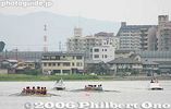
Main race: 8-man crew for Todai and Kyodai coming round the bend on the 3200-meter courseJul 11, 2006
|
|

Todai's 4-man crew in the leadJul 11, 2006
|
|
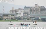
One of the main events, the 4-man boat race between Todai and Kyodai on a 3200-meter course.Jul 11, 2006
|
|

Todai's 4-man crew rowingJul 11, 2006
|
|

Kyodai alumni in their 20s and 30sJul 11, 2006
|
|
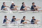
Kyodai alumni in their 20s and 30sJul 11, 2006
|
|

Jul 11, 2006
|
|

Jul 11, 2006
|
|

8-man crew alumni in their 20s and 30s at starting lineJul 11, 2006
|
|

Jul 11, 2006
|
|
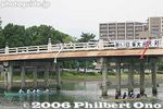
4-man crew alumni boat raceJul 11, 2006
|
|

Kyoto Univ. starts to veer off courseJul 11, 2006
|
|
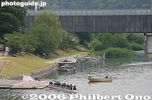
A faulty rudder runs them agroundJul 11, 2006
|
|

Kyoto Univ. is unable to correct their misdirectionJul 11, 2006
|
|
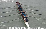
Kyoto Univ. alumniJul 11, 2006
|
|

On Karahashi BridgeJul 11, 2006
|
|

Kyoto Univ. alumni crew at start lineJul 11, 2006
|
|

Race starts for Kyoto Univ. alumniJul 11, 2006
|
|

Kyoto Univ. alumni crew in dark blue T-shirtsJul 11, 2006
|
|

Univ. of Tokyo alumni crew in light blue T-shirtsJul 11, 2006
|
|

View of Seta River race course from Karahashi BridgeJul 11, 2006
|
|

Jul 11, 2006
|
|

Tokyo Univ. (Todai) crew return to land after a raceJul 11, 2006
|
|

Finish line 300 meters laterJul 11, 2006
|
|

Jul 11, 2006
|
|

Kyoto Univ. in dark blue T-shirtsJul 11, 2006
|
|

Alumni race starting at Seta no Karahashi BridgeJul 11, 2006
|
|

PR poster designed by Tetsuo OshiroPoster for the race.
京都大学ボート部OBの尾城徹雄様に作成したポスター。大学内や大津市石山商店街などで張り出された。Jul 11, 2006
|
|
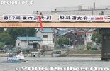
Karahashi Bridge as the starting point for alumni racesJul 11, 2006
|
|

View of Seta River race course, Karahashi Bridge on far left. Tokyo vs. Kyoto Univ. RegattaJul 11, 2006
|
|

Used New Year's decorationsJan 10, 2006
|
|

Karuta Festival. The narrator (standing) recites one of the poems and the contestants must search for and claim the card written with the poem.Jan 10, 2006
|
|

Karuta cards with verses from famous poemsJan 10, 2006
|
|

The Shamusho Shrine office I (社務所I) serves as the Karuta Matsuri tournament venue.Jan 10, 2006
|
|

Jan 10, 2006
|
|

Karuta Festival posterJan 10, 2006
|
|

Jan 10, 2006
|
|

Jan 10, 2006
|
|

Sotokairo corridor (外廻廊), Jinpu-Juyosho shop selling souvenirs (神符授与所), and Rōmon Gate (楼門)Jan 10, 2006
|
|

Jan 10, 2006
|
|

Gift shop and clock museum in background. 時計博物館Jan 10, 2006
|
|

Sun dial. Another one in the background as well. Hidokei I (日時計1: Sundial I)Jan 10, 2006
|
|

CorridorJan 10, 2006
|
|

Inner side of Omi Jingu Shrine's Rōmon Gate (楼門).Jan 10, 2006
|
|

Naihaiden HallJan 10, 2006
|
|

Naihaiden Hall (Inner Haiden 内拝殿)Jan 10, 2006
|
|

Gehaiden Hall (Outer Haiden 外拝殿)Jan 10, 2006
|
|

Omi Jingu Shrine's Rōmon Gate (楼門)Jan 10, 2006
|
|

PoetryJan 10, 2006
|
|

Omi Jingu Shrine's Rōmon Gate (楼門)Jan 10, 2006
|
|

Steps to Rōmon Gate, the shrine's most outstanding structure. (楼門)Jan 10, 2006
|
|

Built in 1940, Omi Jingu Shrine is dedicated to Emperor Tenji who moved the capital to Otsu in 667 at the location of this shrine. Otsu was therefore once the capital of Japan. MAPJan 10, 2006
|
|

Path to shrine. Omi Shrine is a short walk from Omi Jingu-mae Station on the Keihan Ishiyama-Sakamoto Line.Jan 10, 2006
|
|
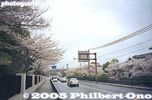
Keage today, incline is on the right of roadOct 24, 2005
|
|

Keage Incline postcardThe Keage Incline was in operation until 1948.Oct 24, 2005
|
|
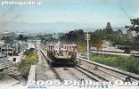
Keage Incline postcardThe Keage Incline was in operation until 1948.Oct 24, 2005
|
|

Oct 23, 2005
|
|

Oct 23, 2005
|
|

Oct 23, 2005
|
|

Oct 23, 2005
|
|

Oct 23, 2005
|
|

Oct 23, 2005
|
|

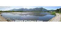
Attached lake behind the beachOct 23, 2005
|
|
Oct 23, 2005
|
|
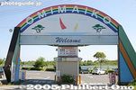
Parking lot entranceOct 23, 2005
|
|

Omi-Maiko Beach Management OfficeOct 23, 2005
|
|

Goddess for lake safetyOct 23, 2005
|
|

Oct 23, 2005
|
|

Oct 23, 2005
|
|

Monument for Biwako Hakkei. "Cool Breeze on White Sands of Omatsu" is one of the Eight Views of Lake Biwa as selected in 1949.Oct 23, 2005
|
|

Oct 23, 2005
|
|

Oct 23, 2005
|
|

Oct 23, 2005
|
|

Marker for OmatsuOmatsu is the old name for Omi-Maiko.Oct 23, 2005
|
|

Oct 23, 2005
|
|

Oct 23, 2005
|
|

Green pine and white sand of Omi-Maiko, Lake Biwa.Oct 23, 2005
|
|

White sands at Omi-Maiko, Lake Biwa.Oct 23, 2005
|
|
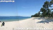
Oct 23, 2005
|
|

Manyoshu MonumentOct 23, 2005
|
|

Oct 23, 2005
|
|

Clear waters and beautiful Lake Biwa beach at Omi-MaikoOct 23, 2005
|
|

Omi-MaikoOct 23, 2005
|
|
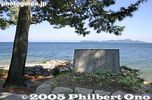
Monument for Lake Biwa Rowing Song (Biwako Shuko no Uta).In June 1917, a song called Biwako Shuko no Uta (Lake Biwa Rowing Song) was composed by college student Taro Oguchi during a boat rowing trip around Lake Biwa. He was a member of the rowing club at Dai-san High School (now Kyoto University). He composed it in Imazu, Shiga Prefecture during the second night of the trip.
The song is about the boys rowing around Lake Biwa while mentioning famous places like Otsu (the starting point), Omi-Maiko (Omatsu), Imazu, Chikubushima, Nagahama, and Chomeiji.
Another boat mate matched Oguchi's lyrics to the melody based on the old song called Water Lilies as modified by a young Chiaki Yoshida. It soon became a popular dormitory song.
Oct 23, 2005
|
|
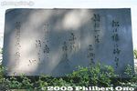
Monument for Lake Biwa Rowing Song (Biwako Shuko no Uta)The song became a national hit in 1971 when singer Tokiko Kato recorded it. Numerous famous Japanese singers and groups have since released cover versions of the song. The town of Imazu even holds an annual song contest in June when choir groups from around Japan sing the song in a competition. The town even has a museum dedicated to the song.
One of the verses mentions Omatsu (now called Omi-Maiko). This monument commemorates the song and that verse.Oct 23, 2005
|
|

Or go right to see the best beaches...Oct 23, 2005
|
|

Go left or right...Disobey the sign and go right to visit the main beach.Oct 23, 2005
|
|

Omi-Maiko Station on JR Kosei Line. It makes it easy for people in Kyoto to visit Omi-Maiko. MAPSign says "Welcome to Omi-Maiko." Omi-Maiko was in the former town of Shiga-cho that merged into Otsu.Oct 23, 2005
|
|

Go left to visit the hotelOct 23, 2005
|
|

Water intake for Lake Biwa Canal No. 1 at MihogasakiOct 23, 2005
|
|

Water intake for Lake Biwa Canal No. 1. Kyoto was thereby revitalized with electric power and a stable water supply. A second, almost parallel canal for drinking water was also constructed in 1912. Oct 23, 2005
|
|

Water intake for Lake Biwa Canal No. 1Oct 23, 2005
|
|
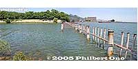
Water intake for Lake Biwa Canal No. 2. The Lake Biwa Canal (Biwako Sosui) supplies water from Lake Biwa in Otsu to Kyoto. After four years of monumental construction, the canal was completed in 1890.Oct 23, 2005
|
|

Water intake for Lake Biwa Canal No. 2Oct 23, 2005
|
|

Water intake for Lake Biwa Canal No. 2. Near Mihogasaki in Otsu, and adjacent to the boat racing arena.Oct 23, 2005
|
|

Water intake for Lake Biwa Canal No. 2Oct 23, 2005
|
|

Top of Keage InclineThe boat would be loaded onto the trolley here, then taken down the incline. Or vice versa.Oct 21, 2005
|
|
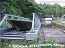
Top of Keage InclineThe boat would be loaded onto the trolley here, then taken down the incline. Or vice versa.Oct 21, 2005
|
|

Keage Hydroelectric Power Plant pipesOct 21, 2005
|
|
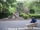
Park near top of Keage InclineOct 21, 2005
|
|

Statue of Sakuro Tanabe, the canal engineerIn the park near top of Keage Incline. The canal is lined with various monuments and writings, especially on the canal tunnel entrances.Oct 21, 2005
|
|
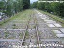
Keage InclineOct 21, 2005
|
|

Keage Incline boat trolleyThe Keage Incline was once restored in 1977. However, the sample boats are in poor condition.Oct 21, 2005
|
|
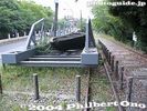
Keage Incline boat trolleyOct 21, 2005
|
|
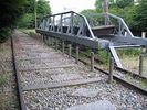
Keage Incline boat trolleyThe Keage Incline was a dry slope which connected the upper part of the canal with the lower part of the canal. Since the canal was disconnected by this dry slope, boat trolleys on rails ferried boats between the upper and lower sections of the canal. It was in operation until 1948.Oct 21, 2005
|
|

Keage InclineThe Keage Incline was a dry slope which connected the upper part of the canal with the lower part of the canal. Since the canal was disconnected by this dry slope, boat trolleys on rails ferried boats between the upper and lower sections of the canal. It was in operation until 1948.Oct 21, 2005
|
|

Bottom of Keage InclineThe Keage Incline was a dry slope which connected the upper part of the canal with the lower part of the canal. Since the canal was disconnected by this dry slope, boat trolleys on rails ferried boats between the upper and lower sections of the canal. It was in operation until 1948.Oct 21, 2005
|
|

Map of canal routeOct 21, 2005
|
|

Bottom of Keage Incline in KyotoOct 21, 2005
|
|
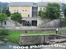
Lake Biwa Canal Museum at bottom of Keage InclineThe museum opened in 1996.Oct 21, 2005
|
|
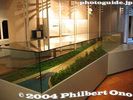
Lake Biwa Canal MuseumModel of Keage Incline.Oct 21, 2005
|
|
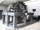
Pelton water wheel at Lake Biwa Canal MuseumUsed at the Keage Power Plant to generate electricity. The Keage Plant was Japan's first hydroelectric power plant.Oct 21, 2005
|
|

Oct 21, 2005
|
|

Lake Biwa Canal Museum in KyotoAt the end of the canal, there's this museum in Kyoto tracing the history of the canal.Oct 21, 2005
|
|

YamashinaOct 21, 2005
|
|
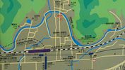
Yamashina map showing the exposed portion of the Lake Biwa Canal near JR Yamashina Station in Kyoto.Oct 21, 2005
|
|
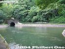
YamashinaOct 21, 2005
|
|
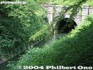
No. 1 Tunnel exitOct 21, 2005
|
|

Oct 21, 2005
|
|
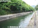
Oct 21, 2005
|
|
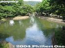
The canal in Kyoto near Yamashina.Oct 21, 2005
|
|
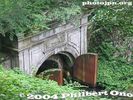
No. 1 Tunnel entrance. Oct 21, 2005
|
|

Water intake for Lake Biwa Canal No. 2. This is the second, almost parallel canal constructed in 1912.Oct 21, 2005
|
|

Water intake for Lake Biwa Canal No. 2. The canal is covered. The water supply for Kyoto and Osaka.Oct 21, 2005
|
|

Water intake for Lake Biwa Canal No. 2Oct 21, 2005
|
|

Karasaki ShrineOct 20, 2005
|
|

Mt. Mikami + Pine Tree at Karasaki.Oct 20, 2005
|
|

Omi Hakkei (Eight Views of Omi) markerOct 20, 2005
|
|

Oct 20, 2005
|
|

Oct 20, 2005
|
|

Mt. Mikami across Lake Biwa from Karasaki.Oct 20, 2005
|
|

Sadly, as of 2023, this Karasaki Pine Tree has largely wilted due to wind and rain over the years. The branches have suffered cumulative damage including hollowing out of the trunk.Oct 20, 2005
|
|

Karasaki Pine Tree is the third generation tree since the original one was planted 1,400 years ago. Current pine tree was planted in 1887. Oct 20, 2005
|
|

Karasaki Pine Tree was still healthy and deep green in 2004.Oct 20, 2005
|
|

Omi Hakkei (Eight Views of Omi) marker at Karasaki. Omi was the old name for Shiga. A woodblock print artist depicted the Eight Views of Omi. One of them was titled, "Night Rain at Karasaki" showing the big pine in the rain at night.Oct 20, 2005
|
|

Pine tree and Lake Biwa.Oct 20, 2005
|
|

Karasaki Shrine torii. It is a branch shrine of Hiyoshi Taisha. 唐崎神社 MAPOct 20, 2005
|
|

Karasaki Shrine has numerous pine trees, including the famous century-old pine tree.Oct 20, 2005
|
|
|
|
|
| 2449 files on 10 page(s) |
 |
 |
 |
 |
10 |
|