 Most viewed Most viewed |
6 views
|
|
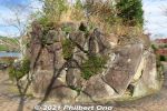
Rocks on the tip of Sazanami Park.6 views
|
|
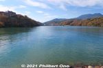
View of Kiso River from the tip of Sazanami Park. Right below Shinonome Ohashi Bridge (東雲大橋) in the distance is Oi Dam built in 1924 as Japan's first hydroelectric dam. The dam created this reservoir in Ena Gorge.6 views
|
|
6 views
|
|
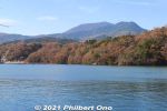
6 views
|
|
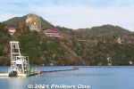
On the right side of Sazanami Park, Ena-kyo Wonderland can be seen on the mountain. An amusement park, closed for winter from Nov. to Feb..6 views
|
|
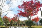
6 views
|
|
6 views
|
|
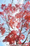
6 views
|
|
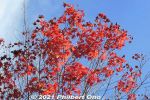
6 views
|
|
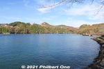
6 views
|
|
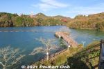
View of Benten Island.6 views
|
|
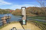
Lookout point on Sazanami Park.6 views
|
|
6 views
|
|
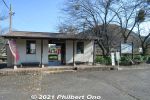
Nearest train station toTanigumi-san is Tanigumiguchi Station on the Tarumi Line. Small little train station with no staff. 6 views
|
|
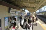
Tarumi Line starts here at JR Ogaki Station on the JR Tokaido Line. You can buy Tarumi Line tickets on the platform when transferring from a JR train.6 views
|
|
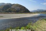
There are some nice views along the train line.6 views
|
|
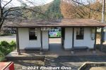
Tanigumiguchi Station, small little train station with no staff.6 views
|
|
6 views
|
|
6 views
|
|
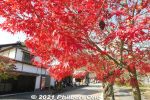
6 views
|
|
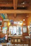
Inside Ibigawa Tourist Information Plaza. 揖斐川町観光プラザ6 views
|
|
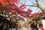
6 views
|
|
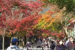
6 views
|
|
6 views
|
|
6 views
|
|
6 views
|
|
6 views
|
|
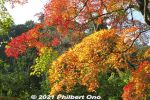
6 views
|
|
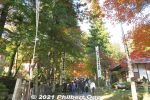
6 views
|
|
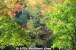
Some greenery too.6 views
|
|
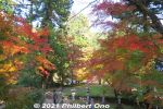
6 views
|
|
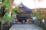
Meioin Temple is where worshippers can receive the temple seal. 明王院6 views
|
|
6 views
|
|
6 views
|
|
6 views
|
|
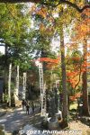
6 views
|
|
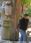
People who completed the 33-temple pilgrimage can rub this fish (made of bronze) to mark the end of their abstinence (精進落ち). The pillar on the left also has a koi fish hanging (not visible).6 viewsThese days, I'm sure most pilgrims do the pilgrimage by car or train. Too far to walk it.
|
|
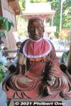
6 views
|
|
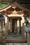
6 views
|
|
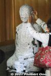
This lady probably wants to cure her impaired hearing. Koke-no-mizu Jizo statue (苔の水地蔵尊)6 views
|
|

The Oizurudo altar hall is where pilgrims who completed the 33-temple Saigoku pilgrimage offer their pilgrimage implements. 6 viewsYou can see walking sticks, Chinaman's hats, and a lot of pilgrims' white oizuru (笈摺) vests (photo) which are like sleeveless happi coats or haori. The pilgrims have it stamped with each temple's vermillion stamp.
|
|
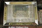
Old group photo of pilgrims who completed the Saigoku Pilgrimage here.6 views
|
|

Offerings inside Koyasu-do. 子安堂6 views
|
|
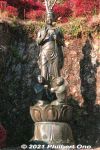
Kannon statue6 views
|
|
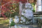
Tanuki is a raccoon dog considered to be an auspicious symbol commonly decorating the entrance to a shop or restaurant.6 views
|
|
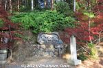
6 views
|
|
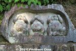
See no evil, speak no evil, and hear no evil by three wise tanuki. Apparently all virile males. Not monkeys, how surprising. 6 views
|
|
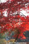
Maples facing the Mangando hall.6 views
|
|
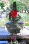
6 views
|
|
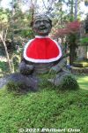
6 views
|
|
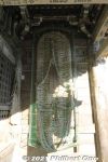
Giant straw sandal on Niomon Gate.6 views
|
|
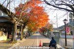
6 views
|
|
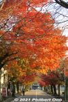
6 views
|
|
6 views
|
|
6 views
|
|
6 views
|
|
6 views
|
|
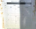
Buses go to Tanigumi-guchi Station (Tarumi Line) or Ibi Station (Ibigawa Line). Very infrequent, so check and remember the return bus schedule when you arrive here.6 views
|
|

Map of Ibigawa Town.6 views
|
|
6 views
|
|
6 views
|
|
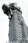
Ryuchu dragon pillar in Naha, Okinawa.6 views
|
|
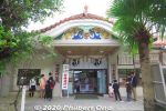
Naminoue Shrine office.6 views
|
|
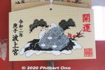
Naminoue Shrine's ema prayer tablet. (For the Year of the Mouse in 2020.)6 views
|
|

Commodore Perry Landing Monument is in the distance. The cemetery has locked gates so we can't enter it. Not really a tourist attraction, but it can be clearly viewed from outside the low fence.6 views
|
|
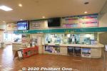
At Tomari Port, ticket window for Kumejima island.6 views
|
|

Today's boat schedule. Check this to make sure your boat has not been canceled due to the weather, etc.6 views
|
|
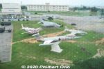
Japan's Air Self-Defense Force base is also at Naha Airport.6 views
|
|

Japan Transocean Air (JTA) Boeing 737-800.6 views
|
|
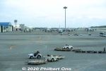
Naha Airport gates have large pictures windows perfect for plane spotting.6 views
|
|
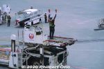
Ramp Marshall signaling a Japan Airlines Boeing 777-200 arriving at the gate at Naha.6 views
|
|
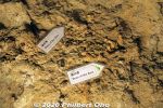
Deer bone fossils.6 views
|
|
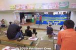
Also popular in Okinawa World is the Habu Museum Park and Habu Show. Habu is Okinawa's venomous snake. Habu Theater for the 20-min. habu show a few times/day.6 views
|
|
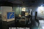
Habu Museum has many interesting exhibits about the habu. There's also some English.6 views
|
|
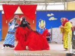
Okinawan shishi-mai lion drinking awamori.6 views
|
|
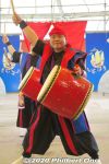
6 views
|
|
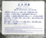
About Uezu Residence. 上州家6 views
|
|
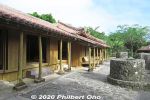
Uezu Residence6 views
|
|

Different sanshin6 views
|
|
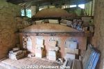
Botom end of the noborigama sloping kiln where the fire starts and the heat climbs up the kiln.6 views
|
|

Jet fighters flying near Futenma Air Base as seen from Hacksaw Ridge. Very common scene above Okinawa's skies.6 views
|
|
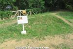
On Hacksaw Ridge, the purported location of Urasoe Castle's Seiden main building where building foundations were found during excavations in 1998. 正殿跡6 views
|
|
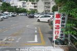
On the way back to the station, noticed this sign saying "Road closed, removing dud bomb." That's how often often they find dud bombs from World War II.6 views
|
|
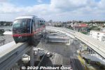
Yui Rail train arriving Urasoe-Maeda Station.6 views
|
|

US-1A 9078 rescue plane that flew from 1983 to 1995. 新明和US-1A救難飛行艇6 views
|
|

About the Wright Flyer, the world's first powered airplane.6 views
|
|

Chronology of Japan's aviation history. The model on the right is the Type 92 Heavy Bomber that first flew in 1931.6 views
|
|
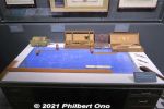
Airplane design drafting table and implements.6 views
|
|
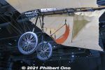
6 views
|
|
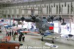
6 views
|
|
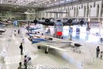
6 views
|
|
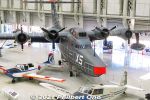
UF-XS Experimental Flying Boat6 views
|
|
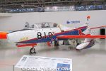
Fuji T-1B from 1960. First jet aircraft made in Japan.6 views
|
|
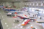
Fuji T-1B6 views
|
|
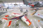
Fuji T-1B6 views
|
|

Mitsubishi-Lockheed F-104J Starfighter6 views
|
|
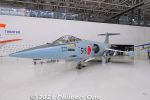
F-104J Starfighter6 views
|
|

Mitsubishi T-2 Blue Impulse aerobatic jet.6 views
|
|
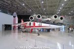
Mitsubishi T-2 Control-Configured Vehicle (CCV) Research jet. T-2CCV研究機6 views
|
|
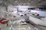
NAL Asuka STOL Research Aircraft6 views
|
|

6 views
|
|
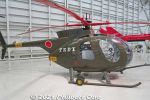
Kawasaki-Hughes OH-6J helicopter. I remember seeing this in movies.6 views
|
|
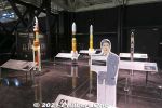
Japan's rockets, all unmanned. Cutout of Itokawa Hideo, aeronautical engineer.6 views
|
|
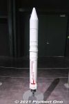
Epsilon rocket.6 views
|
|

Japan's Kibo experiment module (full-scale replica) for International Space Station (ISS). We can go inside. 日本実験棟「きぼう」6 views
|
|

Japanese astronauts from 1990 to present day.6 views
|
|
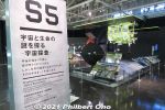
Section S5 is about space probes to learn more about the origin of space and life.6 views
|
|

Improved aircraft technologies and materials have improved the plane's range and efficiency.6 views
|
|
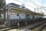
If you're coming from Meitetsu Nagoya Station, you can transfer at Inuyama Station to get on the Kakamigahara Line.6 views
|
|
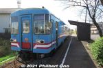
Mieji Station on the Tarumi Line (Tarumi Railway). Unmanned station. 樽見鉄道樽見線 美江寺駅6 views
|
|
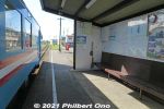
Mieji Station platform on the Tarumi Line.6 views
|
|
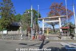
Entrance to Mie Shrine and Mieji Kannon Temple at the corner of the road. 美江神社6 views
|
|
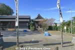
Next to Mie Shrine is Mieji Kanzeon-do Hall. 観世音堂6 views
|
|
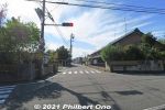
Turn the corner here.6 views
|
|
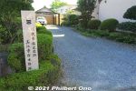
Site of Mieji-juku's Honjin (VIP lodging). 6 views
|
|
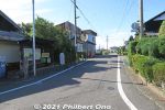
Turn right here.6 views
|
|
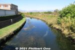
This is the spot depicted by Hiroshige's woodblock print of Mieji-juku. Saikawa River.6 views
|
|

Soaping area.6 views
|
|
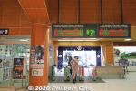
Kinugawa Onsen Station.6 views
|
|
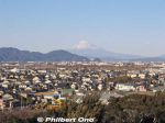
Mt. Fuji can be seen from Koyama Castle.6 views
|
|

Fishing boat sailing past Manazuru Peninsula.6 views
|
|

Niseko Hirafu has both easy and steep (moguls) slopes. ニセコ ヒラフ6 views
|
|

Skiing on Niseko Annupuri. ニセコアンヌプリ6 views
|
|

Bihoro Pass is within Akan-Mashu National Park. 6 views
|
|
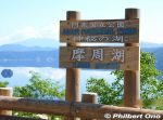
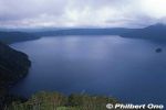
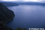
Newer Lake Mashu sign at a lookout point. 6 views
|
|
6 views
|
|
6 views
|
|
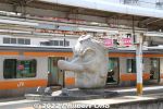
Takao Baigo is near JR Takao Station and Keio Line Takaosanguchi Station. JR Takao Station has this giant tengu mask on the platform. Mt. Takao, which has long been a sacred mountain, supposed to be where one of the major tengu dwells. 6 viewsSo the tengu is a local symbol.
|
|

Bus stops between the two nearest train stations and Takao Baigo.6 views
|
|
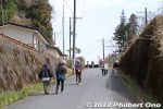
Walking to Kogesawa Bairin.6 views
|
|
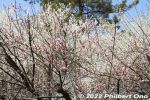
6 views
|
|
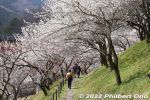
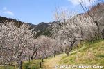
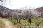
The plum grove has walking paths across the slope.6 views
|
|
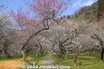
Top of Kogesawa Bairin. Plum tree branches seem to grow in random directions, but the tree always maintains its balance.6 views
|
|
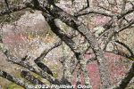
Plum trees also have lichens growing on the trunk and branches. These lichens form on plum trees in rural areas. We don't see them on plum trees in the city because exhaust fumes from vehicles kill them. 6 viewsSo if you see these lichens on plum trees, it means the surrounding environment is very clean. (Parmotrema tinctorum ウメノキゴケ)
|
|
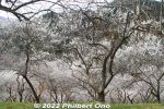
Looking down the hillside of white plum trees.6 views
|
|
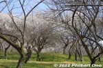
6 views
|
|
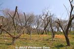
Some plum trees with pruned branches. May they flower again someday.6 views
|
|
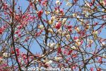
6 views
|
|
6 views
|
|
6 views
|
|
6 views
|
|
6 views
|
|
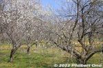
6 views
|
|
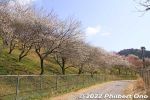
6 views
|
|
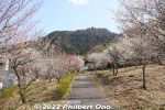
Surusashi Bairin6 views
|
|
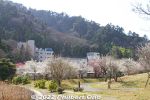
Takao Ume-no-Sato Machi-no-Hiroba is more for picnicking.6 views
|
|

6 views
|
|
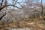
6 views
|
|
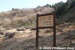
Next to Tenjin Bairin is this reforestation area.6 views
|
|
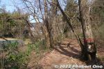
Walking path along the river.6 views
|
|

Lake Kussharo is another scenic lake in Akan-Mashu National Park in eastern Hokkaido. Japan's largest caldera lake. Unlike Lake Mashu, Kussharo is accessible to tourists like here at Sunayu.6 views
|
|

Boats can be rented at Sunayu. In May 1938, the Kussharo Earthquake had sulfates seep into the lake from the lake bottom, making the water too acidic (pH4) for fish which got wiped out. 6 views
|
|

6 views
|
|
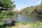
Some cherry blossoms along Junsai-ike Pond. じゅん菜池6 views
|
|
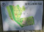
Map of Satomi Park. The burial mound is on the upper part next to the red, dotted oval on the map. The park is next to Edogawa River.6 views
|
|
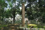
Marker indicating Ichikawa city's highest point (elevation). A whopping 30.1 meters above sea level.6 views
|
|
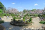
Satomi Park water fountain. This is another area of the park. Totally different landscape. This was the main site of Konodai Castle. 国府台城6 views
|
|
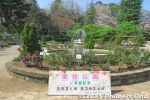
Satomi Park visit date.6 views
|
|
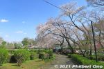
Satomi Park cherry blossoms.6 views
|
|
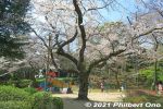
6 views
|
|
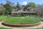
Satomi Park is also noted for roses in early summer and fall. The rose is Ichikawa's official flower. 6 views
|
|
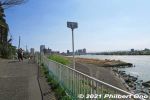
江戸川沿い6 views
|
|
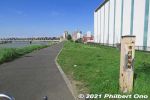
Ichikawa Sekisho marker near Yamazaki Baking.6 views
|
|
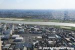
View from I-Link Town Observatory, looking west toward Edogawa River. This deck is open 9 am to 10 pm. Closed on the first Monday of the month and during Dec. 29 to Jan. 3.6 views
|
|
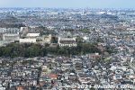
"Temple" marks the location of Guhoji Temple, famous for a 400-year-old weeping cherry blossom tree. See this album.6 views
|
|
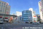
In front of Ichikawa Station, the building (Sun Plaza 55) on the left has a coffee shop and bakery operated by Yamazaki Baking.6 views
|
|
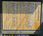
Poem about Tekona.6 views
|
|
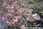
6 views
|
|
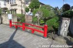
Mama no Tsughihashi Bridge near the steps going up to Guhoji Temple. The bridge is mentioned in some poems in the Man'yoshu. 真間の継橋6 views
|
|
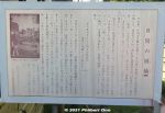
About Mama no Tsughihashi Bridge. 真間の継橋6 views
|
|
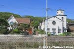
Western-style buildings along Mama River. The Christian church on the right is the Japan Evangelical Lutheran Church in Ichikawa and a National Tangible Cultural Property. 日本福音ルーテル市川教会【国登録有形文化財】6 views
|
|

Mama River empties into Edogawa River. We later walked along Edogawa River toward Konodai Station on the Keisei Line.6 views
|
|
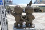
Back of the Monchicchi statue. Shin-Koiwa is where Sekiguchi Corporation, the toy company which invented Moncchichi, is based. モンチッチ像6 views
|
|
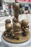
These Monchicchi monuments were donated by Sekiguchi Koichi, chairman of Sekiguchi Co., Ltd. which created Monchicchi.6 views
|
|
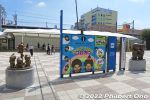
Back of the Moncchichi monuments in front of Shin-Koiwa Station, not to be confused with Koiwa Station. Shin-Koiwa Station is in Katsushika Ward while adjacent Koiwa Station is in Edogawa Ward. They are two different stations easy to mix up.6 views
|
|
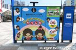
There's a boy and girl Monchicchi usually depicted as infants sucking their thumbs.6 views
|
|
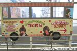
6 views
|
|

The park's main area (evacuation zone) is open 24/7, but Monchicchi Zone is gated and open from 9:00 a.m. to 6:00 p.m. during April to September and 9:00 a.m. to 5:00 p.m. during Oct. to March. Closed from Dec. 29 to Jan. 3.6 views
|
|
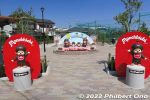
This new Monchicchi Zone has 27 Monchicchi/Sekiguchi statues all donated by the Sekiguchi Koichi, company chairman.6 views
|
|

Monchicchi Mini Museum exhibit panel explaining about Monchicchi.6 views
|
|

There's also baby Monchicchi named Bebichhichi-kun (boy on the left) and Bebichhichi-chan (girl).6 views
|
|
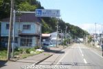
Road signs in Fukushima, Matsumae point the way to Yokozuna Chiyonoyama and Chiyonofuji Memorial Hall.6 views
|
|
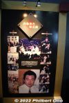
About Chiyonofuji.6 views
|
|
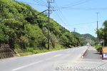
Amami Oshima is slightly larger than the Hawaiian island of Molokai.6 views
|
|
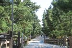
Soka-Matsubara pine tree path.6 views
|
|
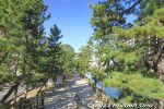
Northern view from Hyakutai Bridge.6 views
|
|

About Soka Matsubara as a Scenic Place Along Oku-no-Hosomichi. It's one of the 25 designated Scenic Places along the Oku-no-Hosomichi extending over 12 prefectures.6 views
|
|

6 views
|
|
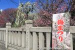
Plum Blossom Festival (Ume Matsuri) sign.6 views
|
|
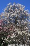
6 views
|
|
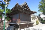
Omurai Katori Shrine's Sacred Dance stage.6 views
|
|
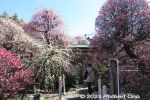
Entrance to the plum garden on the right side of the shrine. 6 views
|
|
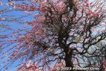
Under a tall, weeping plum blossom tree.6 views
|
|
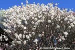
6 views
|
|
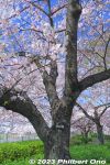
6 views
|
|
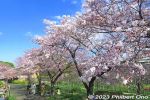
These were still one or two days before peak bloom.6 views
|
|
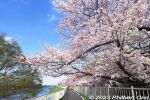
6 views
|
|
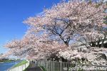
6 views
|
|
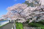
6 views
|
|
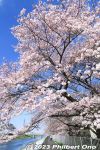
6 views
|
|
6 views
|
|
6 views
|
|
6 views
|
|
6 views
|
|
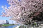
6 views
|
|
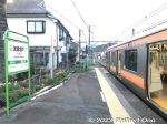
JR Musashi-Masuko Station platform. From central Tokyo, the train ride took about 1 hr. 20 min. JR武蔵増戸駅6 views
|
|
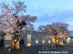
In front of Musashi-Masuko Station are these two Yasube'e cherry blossom trees. The third one is further toward the right.6 views
|
|
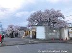
The third cherry tree is the largest, seen here over the train station building.6 views
|
|
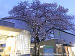
The third cherry tree at JR Musashi-Masuko Station.6 views
|
|
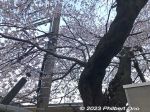
The third cherry tree is already entangled with power lines. This one has to go, sadly.6 views
|
|
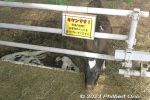
Calf in the pasture. 放牧場6 views
|
|
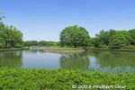
The park has multiple ponds, but this Waterfowl Pond is the largest one.6 views
|
|
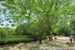
Lots of large trees for shade.6 views
|
|
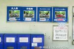
Types of bicycles available for rent. But all gone. Long wait.6 views
|
|
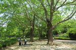
More large trees.6 views
|
|
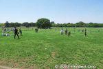
Center of the park is this large lawn where people can play. Called "Minna no Harappa" or Field for All. みんなの原っぱ6 views
|
|
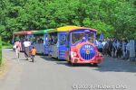
Train-shaped bus to get around the park.6 views
|
|
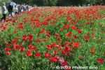
The field of red poppies has a walking path in the middle. Poppy field is much bigger than it looks.6 views
|
|
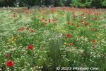
6 views
|
|
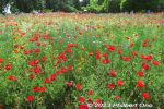
The field of red poppies at Showa Kinen Park.6 views
|
|
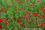
The field of red poppies at Showa Kinen Park.6 views
|
|
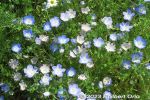
Closeup of nemophila (baby blue eyes) 6 views
|
|
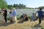
Showa Kinen Park also has a large slope with nemophila (baby blue eyes). Crowd favorite.6 views
|
|
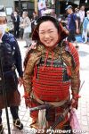
On May 3, 2023, 260,000 turned out to see 59th Odawara Hojo Godai Matsuri samurai parade highlighted by five Hojo Odawara Castle lords and their ladies in colorful costumes. Held for the first time in four years due to the pandemic.6 views
|
|
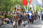
The first Odawara Hojo lord, Hōjō Sōun played by actor Goda Masashi. 初代北条早雲 (合田 雅)6 views
|
|
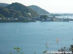
6 views
|
|
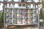
Sake barrels.6 views
|
|
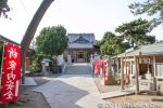
Morito Daimyojin Shrine on the Morito Coast. 森戸大明神6 views
|
|
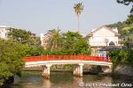
Misogi Bridge. みそぎ橋6 views
|
|
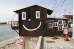
Smiley face on Shin-Nase Beach. PR for a local exhibition.6 views
|
|
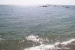
View from Denny's restaurant (Hayama-Morito Branch).6 views
|
|
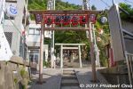
Kumano Shrine in Hayama, Kanagawa Prefecture. 熊野神社6 views
|
|
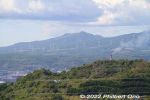
6 views
|
|

Mt. Sokuryo (elevation 199.6 m) is another scenic point on Etomo Peninsula with panoramic views. "Sokuryo" means "measurement" because it was used as a base point in surveying the distance between Muroran and Sapporo in 1872. 6 views
|
|
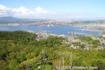
Mt. Sokuryo has a clear view of Muroran Port. The mountain is a 50-min. walk or 10-drive from JR Muroran Station. It's uphill, so going by car/taxi is recommended.6 views
|
|
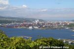
測量山展望台6 views
|
|
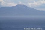
Mt. Komagatake as seen from Mt. Sokuryo in Muroran.6 views
|
|
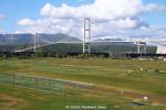
Hakucho Bridge, Muroran. Built in 1998. 白鳥大橋6 views
|
|
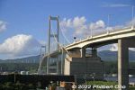
Hakucho Bridge, Muroran. 白鳥大橋6 views
|
|

JR Muroran Station6 views
|
|
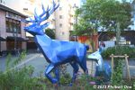
Harry Potter’s stag Patronus and doe near Toshimaen Station.6 views
|
|
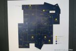
Floor map.6 views
|
|

Door to the Great Hall to start the tour.6 views
|
|
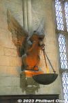
6 views
|
|
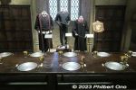
Tableware in the Gryffindor section with their robes displayed behind.6 views
|
|
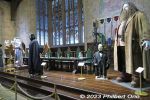
Great Hall’s head table.6 views
|
|
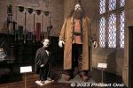
Hagrid6 views
|
|
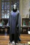
Severus Snape, potions professor and later Defence Against the Dark Arts professor at Hogwarts and Head of Slytherin House.6 views
|
|
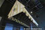
Great Hall roof model.6 views
|
|
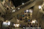
Hogwarts Marble Staircase which actually moves (swivels).6 views
|
|
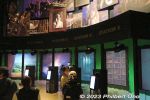
Moving portrait experience: Next to the Marble Staircase, you can be a moving portrait too. The studio’s first interactive experience has booths with different backgrounds to film yourself for 15 seconds.6 views
|
|
| 71462 files on 284 page(s) |
 |
 |
281 |  |
 |
|