 Most viewed - Manazuru 真鶴町 Most viewed - Manazuru 真鶴町 |

Fishing boat sailing past Manazuru Peninsula.4 views
|
|
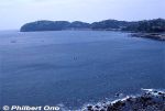
Manazuru Peninsula is a small, scenic spit of rocky and hilly land jutting into Sagami Bay, western Kanagawa. The forest on the peninsula is one of Japan's Top 100 Forests (森林浴の森100選) as designated by Japan's Forestry Agency.3 views
|
|

At low tide, you can walk to Cape Manazuru whose tip has Mitsu-ishi (三ツ石) or Rock Trio.3 views
|
|
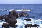
Fishing boat sailing past Manazuru Peninsula.3 views
|
|
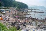
Manazuru Peninsula is also a popular scuba diving spot (Kotogahama), especially for beginner divers training to receive their diving license. Divers can just enter the water from shore, no need for a boat. Cars can also be parked nearby.3 views
|
|

Scuba divers taking a break on shore at Manazuru Peninsula. Stoney shore, no sandy beach.3 views
|
|

School of small fish. Most of my underwater photos were shot too close and came out blurry.3 views
|
|
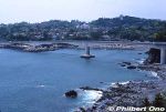
The bridge going to Manazuru Peninsula is on Route 135.1 views
|
|
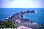
The tip of Manazuru Peninsula has this slim, rocky shoal called Cape Manazuru (真鶴岬).1 views
|
|

Cape Manazuru tip with Mitsu-ishi (三ツ石) or Rock Trio. Two of the pointy rocks are bound by a shimenawa sacred rope. It's a noted spot for watching the New Year's first sunrise which rises between the two roped rocks.1 views
|
|

Mitsu-ishi (三ツ石) rocks bound by a shimenawa sacred rope.1 views
|
|
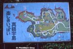
Old map of Manazuru Peninsula.1 views
|
|
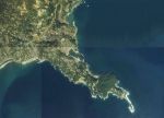
Aerial photo of Manazuru Peninsula from 1983. Cape Manazuru is clearly visible.1 viewsCopyright © National Land Image Information (Color Aerial Photographs), Ministry of Land, Infrastructure, Transport and Tourism
|
|
|
|
|
|
|